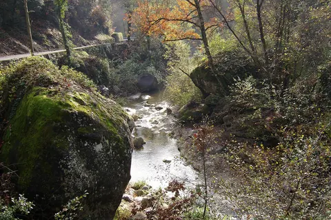
The Paillon is a coastal river of the Alpes-Maritimes that flows into the Mediterranean Sea in Nice, near the old district. It is 35.8 km long. Its drainage basin is 258 km2. Its source is north of Lucéram. It flows generally south, through L’Escarène, Peillon, Drap, La Trinité, and finally Nice.
Being a typical Mediterranean river with low water level throughout the year but with the autumn and winter rains can turn violent with damaging floods.
The region of the Paillon and the Paillon de Contes is called the pays des Paillons. The river course was covered and converted into a subterranean stream for its last few kilometers in the city of Nice starting at Rue Georges Chapel to its mouth at Plage de Carras. Two major buildings built over the stream are the LGT Lyceé Guillaume Apollinaire Nice High School the Palais des Congrès Acropolis.
Places in the district
- Hôtel de Ville340 m
- Place Masséna360 m
- Opéra de Nice390 m
- Palais de la Méditerranée390 m
- Avenue Jean Médecin670 m
- Nice Cathedral710 m
- Church of Gesù800 m
- Palais Lascaris840 m
Sources
Text: introduction of the Wikipedia article Paillon, under the CC BY-SA 4.0 licence (authors: article history). Facts: Wikidata (CC0). Coordinates: Wikidata, map background © OpenStreetMap contributors.